Surveying the Ocean's Topography, from Space

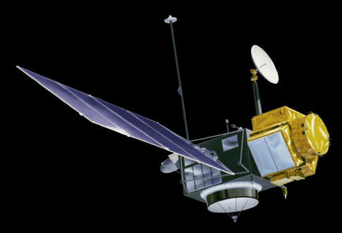
Twenty years ago today — August 10, 1992 — an Ariane 42P launch vehicle launched from Kourou, French Guiana, carrying the TOPEX/Poseidon satellite.


(TOPEX/Poseidon. NASA image.)

Officially the Ocean Topography Experiment, TOPEX/Poseidon was a joint mission between NASA and France’s Centre National d’Etudes Spatiales to measure sea-surface heights from a space-based radar platform. It was also the second spacecraft in the “Mission to Planet Earth” program.

The TOPEX/Poseidon spacecraft was decommissioned in January 2006, but the Jason-1 and Jason-2 follow-on spacecraft are continuing the mission. The Ocean Surface Topography page presents details on all of the missions associated with the space-based study of our world’s oceans.

So, next time you’re at the beach and thinking about how high the waves are, remember that satellites hundreds of miles above you are looking down, thinking about the same thing.

Facebooktwitterpinterestlinkedinmailby feather

A Shuttle Flight More Than Two Decades in the Making

Five years ago today — August 8, 2007 — the Space Shuttle Endeavour launched from Kennedy Space Center on an International Space Station construction mission.


(Mission specialist Barbara Morgan on the shuttle’s middeck during STS-118. NASA image.)

On mission STS-118, U.S. astronauts Scott J. Kelly, Charles O. Hobaugh, Richard A. Mastracchio, Barbara R. Morgan, Tracy E. Caldwell, and Benjamin Alvin Drew, along with Canadian astronaut Dafydd (Dave) Williams, delivered and installed a new truss segment to the ISS. They also replaced a failed control moment gyro — part of the attitude control system that keeps the station in the correct orientation — and transferred supplies for the station residents.

Astronaut Morgan was originally Christa McAuliffe’s back-up for the STS-51L mission that ended when the Challenger was destroyed. The June 2007 mission overview for STS-118 explained,

Morgan trained side by side with McAuliffe and witnessed the 1986 Challenger accident in which McAuliffe and her six fellow crew members died. The Teacher in Space Project was suspended then, but Morgan held on to her NASA ties. In the months following that tragedy, she went on the visits McAuliffe would have made, talking to children and teachers all over the country. Then, when she was selected in 1998 to become a full-fledged astronaut, she jumped at the opportunity.

In 2002, Morgan was chosen as the first educator to become a mission specialist astronaut. The Educator Astronaut Project evolved from the Teacher in Space Project. Both aimed to engage and attract students to explore the excitement and wonder of spaceflight and to inspire and support educators. Morgan’s primary duty is the same as it is for the entire crew — accomplish the planned objectives of the station assembly mission.

She had been selected as the Teacher in Space backup candidate in July 1985, and so waited 22 years for her space mission. No wonder she looks happy, though it must have been somewhat bittersweet.

Facebooktwitterpinterestlinkedinmailby feather

Mission to Planet Earth

Fifteen years ago today — August 7, 1997 — the Space Shuttle Discovery launched from the Kennedy Space Center on a mission to study the Earth’s atomosphere from space.


(Discovery‘s payload bay, outfitted with experimental packages for STS-85. NASA image.)

Astronauts Curtis L. Brown, Jr., Kent V. Rominger, N. Jan Davis, Robert L. Curbeam, Jr., Stephen K. Robinson, and Canadian Space Agency astronaut Bjarni Y.Tryggvason made up the crew of mission STS-85. Their mission was the second to carry the Cryogenic Infrared Spectrometers and Telescopes for the Atmosphere, Shuttle Pallet Satellite (with the unwieldy acronym CRISTA-SPAS) as part of the “Mission to Planet Earth.” They deployed the pallet shortly after reaching orbit, and retrieved it on August 16th.

STS-85 also carried the Japanese Manipulator Flight Development (MFD) system; two “hitchhiker” payloads, Technology Applications and Science-01 (TAS-1) and the International Extreme Ultraviolet Hitchhiker-02 (IEH-02), and a variety of smaller experiment packages in the main cabin. The crew “also worked with the Orbiter Space Vision System (OSVS), which [was] used during ISS assembly.” They returned to Earth on August 19th.

Facebooktwitterpinterestlinkedinmailby feather

Curiosity Has Landed

A few hours ago the Mars Science Laboratory, also known as the Curiosity rover, landed successfully on the red planet.


(One of Curiosity’s first pictures from Mars. According to the official NASA description, this image was “taken through a ‘fisheye’ wide-angle lens on the left ‘eye’ of a stereo pair of Hazard-Avoidance cameras on the left-rear side of the rover. The image is one-half of full resolution. The clear dust cover that protected the camera during landing has been sprung open. Part of the spring that released the dust cover can be seen at the bottom right, near the rover’s wheel.”)

Here’s the full story from Spaceflight Now. Congratulations to the spacecraft’s designers, builders, launch team, and operators on the pinpoint approach and the success of the “sky crane” that deposited the rover safely on the surface. Well done!

The rover landed in Gale Crater, which pleases me immensely since the main character of my novel is named Gale (nicknamed “Stormie”). I may need to add a suitable reference in the text.

As I wrote in a recent related post, I look forward to Curiosity’s trek and discoveries.

Facebooktwitterpinterestlinkedinmailby feather

Anticipating a Mars Landing, Remembering A Mars Lander

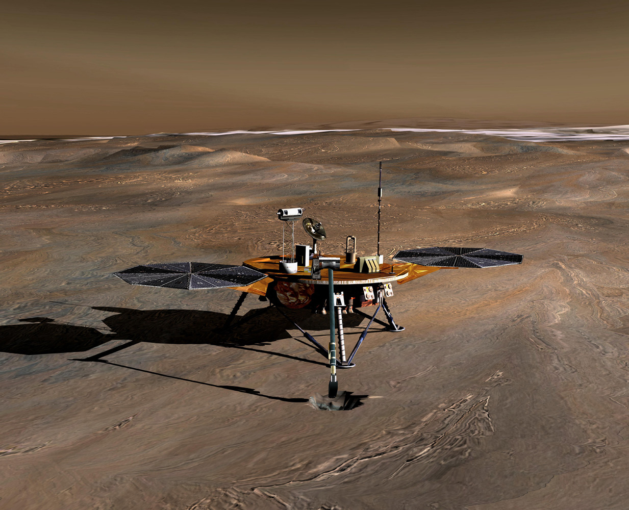
As we get ready for the landing of the Curiosity rover, a bit of space history: 5 years ago today — August 4, 2007 — a Delta II rocket launched from Cape Canaveral carrying the Phoenix Mars Lander.


(Phoenix Mars Lander. NASA conceptual image.)

The Phoenix was designed to analyze soil samples dug from below the Martian surface. It landed in Mars’ north polar region on 25 May 2008:

Fourteen minutes before touchdown, and about 7 minutes before atmospheric entry (defined as reaching an altitude of 125 km) the cruise stage was jettisoned. The spacecraft entered the atmosphere and the heat shield initially slowed the craft. After about 3 minutes the parachute deployed, followed by ejection of the heat shield 15 seconds later, deployment of landing legs 10 seconds after that, and radar activation 50 seconds later. At 1 km altitude the parachute was released and a powered descent and soft-landing was achieved using a pulsed propulsion system with 8 thrusters, which turned off when footpad sensors detected touchdown.

In terms of the Martian year, the spacecraft landed near the summer solstice, at a high enough latitude that the sun would be above the horizon for several more months. This provided ample power through the summer months, but ensured that when winter came the craft would not be able to replenish its batteries. As a result, the mission came to an end when the lander sent its last transmission on 2 November 2008. And according to this mission page, Mars Reconnaissance Orbiter images taken in 2010 showed that winter snow and ice damaged the lander’s solar panels.

Phoenix confirmed the presence of water ice on Mars, and also determined that the Martian soil is moderately alkaline.

And as we post this, the Mars Science Laboratory, Curiosity, is on course for the red planet. We look forward to the landing, and some new discoveries!

Facebooktwitterpinterestlinkedinmailby feather

Last of the Pre-Apollo Lunar Orbiters

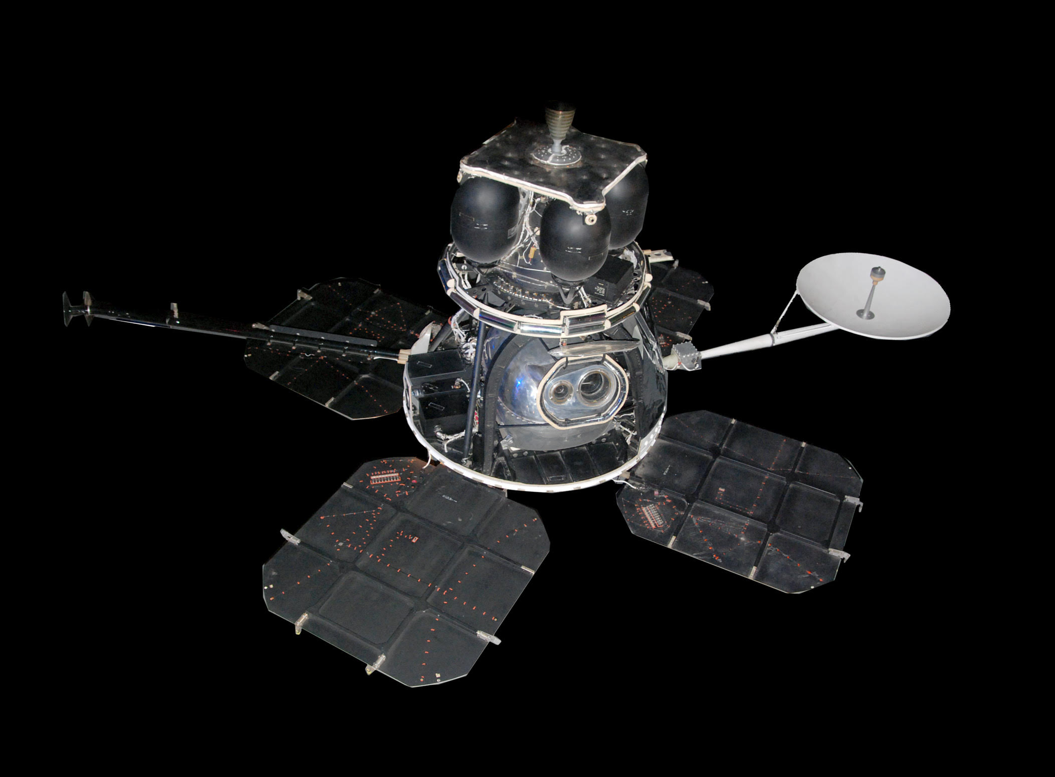
Forty-five years ago today — August 1, 1967 — Lunar Orbiter 5 was launched by an Atlas Agena from Cape Canaveral.


(Lunar Orbiter 5. NASA image.)

As noted, Lunar Orbiter 5 was the last of the series, “designed to to take additional Apollo and Surveyor landing site photography and to take broad survey images of unphotographed parts of the Moon’s far side.”

The spacecraft acquired photographic data from August 6 to 18, 1967, and readout occurred until August 27, 1967. A total of 633 high resolution and 211 medium resolution frames at resolution down to 2 meters were acquired, bringing the cumulative photographic coverage by the 5 Lunar Orbiters to 99% of the Moon’s surface.

Mission Control commanded Lunar Orbiter 5 to de-orbit and hit the lunar surface five months after its photography mission was completed.

Facebooktwitterpinterestlinkedinmailby feather

Testing Tethers in Space History

Twenty years ago today — July 31, 1992 — the Space Shuttle Atlantis launched from the Kennedy Space Center on an international science mission.


(Tethered Satellite System. The tether itself is partly in shadow in this NASA image.)

STS-46 included U.S. astronauts Loren J. Shriver, Andrew M. Allen, Marsha S. Ivins, Jeffrey A. Hoffman and Franklin R. Chang-Diaz, Swiss astronaut Claude Nicollier, and Italian astronaut Franco Malerba.

Though technical problems delayed operations, the crew successfully deployed the European Space Agency’s European Retrievable Carrier (EURECA), an experiment-filled platform that stayed in orbit almost a year before being retrieved by the shuttle Endeavour. The Tethered Satellite System (TSS), a joint NASA/Italian Space Agency venture to test the behavior of tethers in space, did not deploy as planned; however, as a test, it proved that extending tethers in space is a more difficult and delicate task than anticipated.

Facebooktwitterpinterestlinkedinmailby feather

Riding the Earth's Wake, and Farewell to a Space Pioneer

To start this space history item off in the usual fashion: 20 years ago today — July 24, 1992 — a Delta II launch vehicle carried the Geotail satellite to orbit from Cape Canaveral.

Geotail was built by Japan’s Institute of Space and Aeronautical Science as one of the International Solar Terrestrial Physics (ISTP) missions to study the interactions between the Earth and the Sun. Geotail primarily studied the magnetotail, a region formed by the solar wind interacting with the Earth’s magnetic field.

___

Unfortunately, we close this post by saying goodbye to a lady who made space history: physicist and astronaut Dr. Sally Ride, the first U.S. woman in space. Dr. Ride died yesterday of pancreatic cancer. Here’s a very nice profile from Spaceflight Now.


(Sally Ride. NASA image.)

Farewell, Sally Ride.

Facebooktwitterpinterestlinkedinmailby feather

Revolutionizing Civilian Remote Sensing: The Launch of Landsat 1

Forty years ago today — July 23, 1972 — the Earth Resources Technology Satellite (ERTS) 1 launched from Vandenberg AFB atop a Delta rocket.

Renamed Landsat 1, the satellite was the first to demonstrate global remote sensing for “agricultural and forestry resources, geology and mineral resources, hydrology and water resources, geography, cartography, environmental pollution, oceanography and marine resources, and meteorological phenomena.”


(Landsat images of Mount St Helens. NASA image.)

According to this Landsat page, the choice of wavelengths for Landsat’s multispectral scanner (MSS) “was primarily based on forestry and geologic applications that had traditionally used Color IR photography.” At the time, multispectral imaging was “secondary and highly experimental,” according to this page, but scientists soon recognized the utility of the multispectral data.

The spacecraft operated until January 1978, five years longer than expected.

Facebooktwitterpinterestlinkedinmailby feather

For Want of a Hyphen, the Spacecraft Was Lost

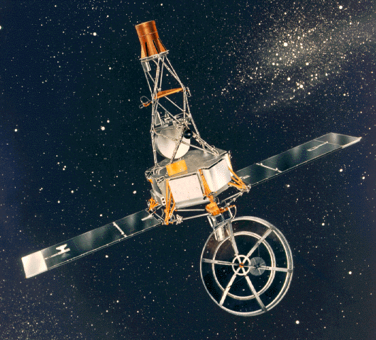
Fifty years ago today — July 22, 1962 — an Atlas Agena rocket launched from Cape Canaveral, carrying the Mariner 1 spacecraft.


(Artist’s conception of Mariner 1. NASA image.)

Mariner 1 was intended to fly by the planet Venus. The flight was nominal

until an unscheduled yaw-lift (northeast) maneuver was detected by the range safety officer. Faulty application of the guidance commands made steering impossible and were directing the spacecraft towards a crash, possibly in the North Atlantic shipping lanes or in an inhabited area.

Range safety destroyed the vehicle 4 minutes and 53 seconds into the launch.

The launch failure investigation found two apparent causes. First, the “Atlas airborne beacon equipment” did not operate properly. In addition,

the omission of a hyphen in coded computer instructions in the data-editing program allowed transmission of incorrect guidance signals to the spacecraft. During the periods the airborne beacon was inoperative the omission of the hyphen in the data-editing program caused the computer to incorrectly accept the sweep frequency of the ground receiver as it sought the vehicle beacon signal and combined this data with the tracking data sent to the remaining guidance computation. This caused the computer to swing automatically into a series of unnecessary course corrections with erroneous steering commands which finally threw the spacecraft off course.

Anyone who has done any computer coding knows how critical even a single character can be. In this case, it cost an entire spacecraft. The Venus flyby would have to wait.

Facebooktwitterpinterestlinkedinmailby feather