Fifteen years ago today — July 2, 1996 — a Pegasus-XL rocket lofted a small meteorological satellite into orbit.
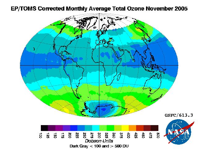
(Ozone map based on TOMS data. NASA image.)
The Total Ozone Mapping Spectrometer-Earth Probe, or TOMS-EP (or sometimes EP/TOMS), spacecraft operated until late 2005, and measured the distribution of ozone throughout the Earth’s atmosphere. The data set is quite extensive; if you’re curious, from this page you can find an historical record of ozone measurements for a location near you.